Mapping Methane Emissions as a Strategy to Limit Global Warming
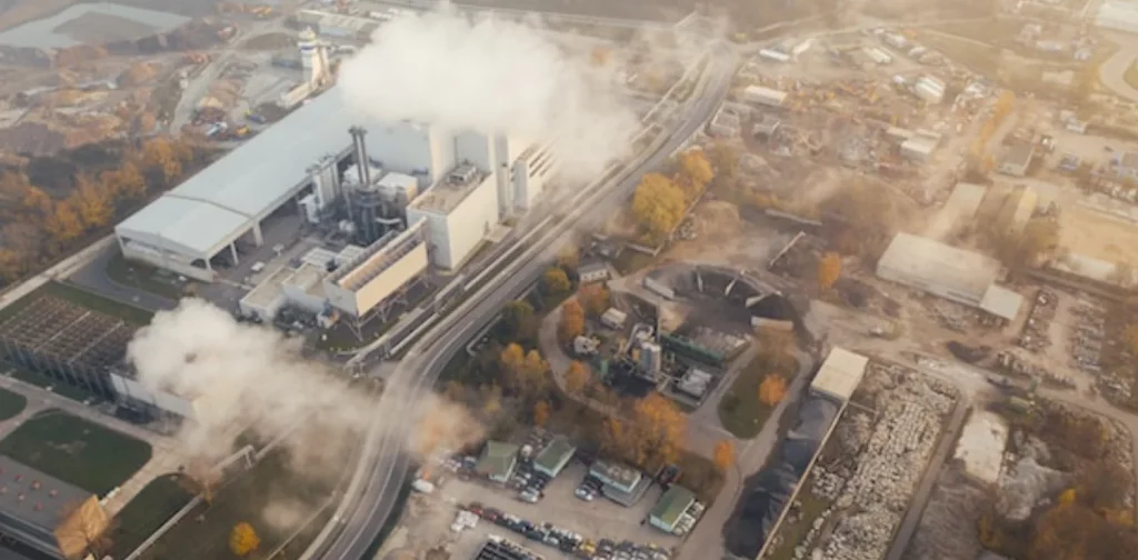
Photo: Marcin Jozwiak on Unsplash.
Did you know that methane is the second largest contributor to global warming? While carbon emission takes first place, methane is more potent in the long run. Various organizations are mapping methane emissions using satellite imagery as a part of their reduction strategies to limit global heating to 1.5 °C.
Understanding Methane Emissions
Methane is a colorless, odorless, and highly flammable gas. It is probably the most abundant organic compound on the planet and the main component of natural gas. It can occur naturally or as a result of human activities.
Most naturally produced methane is offset into natural sinks, which include soil and the methane oxidation process in the atmosphere. However, human activities produce methane faster and more than it can sink.
As a result, methane is responsible for about 30% of global temperature rise since the Industrial Revolution. While it contributes less than carbon dioxide, methane is 86 times more potent than CO2 over a 20-year time scale.
IEA reported an estimated 355,801kt of global methane emissions in 2022. Asia Pacific accounted for the largest share, contributing 38.2%. Industry-wise, the agriculture sector (40%) led the number, followed by energy and waste.
Satellite Imagery for Mapping Methane Emissions
Reducing methane emissions becomes crucial to keeping the earth’s temperature from breaching the 1.5 °C threshold. Organizations and companies have utilized satellite imagery to identify major methane emissions and leaks. In general, the satellites detect and measure the presence of methane by observing the earth’s atmosphere and using infrared bands. It can also be used to identify the overall trends across industries and places, as well as support other efforts for sustainable development.
In the energy sector, data from the International Energy Agency (IEA) shows that a total of 3 million tonnes of methane leaks from fossil fuel operations were detected by satellite in 2022. In one instance, a satellite belonging to space and tech company GHGSat detected leaks from four gas pipelines at Nord Stream, Baltic Sea, at a rate of 79,000 kg/h. This equals burning over 1 million kilograms of coal an hour.
Utilizing satellite imagery for mapping methane emissions in the waste sector is also crucial as one of the major contributors to methane emissions. A non-profit organization, Carbon Mapper, plans to use NASA’s data and satellite instruments to conduct a remote-sensing survey in landfills across the USA, Canada, and selected locations in Latin America, Africa, and Asia.
The Global Methane Hub is also developing a global platform called the Waste Methane Assessment Platform (Waste MAP) for methane emission mapping from the waste sector using satellite monitoring. The platform’s beta version currently displays data from several methane emission hot spots, including Mumbai, New Delhi, Mexico City, and Casablanca.
Reducing Methane Emissions
Methane is a vital greenhouse gas to target in emission reduction, and bold actions are needed. The Global Methane Pledge is an initiative launched in 2021 to reduce global methane emissions and keep the goal of limiting warming to 1.5 °C within reach. Around 150 countries have now joined the Global Methane Pledge, which aims to reduce methane emissions from human activity by 30% from 2020 levels by 2030.
Data from mapping methane emissions will allow governments, organizations, and companies to address current issues and prevent future leaks. To support this, the UN Environment Programme recently launched its satellite methane mapping system called the Methane Alert and Response System (MARS) to detect very large leaks and alert the operators and regulators.
Still, reducing methane emissions from industry operations is a top priority. With the data gathered through satellite imagery methane mapping, industry players can monitor the environmental impacts of their operations. Additionally, governments can also utilize this data to enforce regulations and sanctions when necessary. Combined with these multi-stakeholder efforts, mapping methane emissions becomes an essential step in reducing greenhouse gas emissions and limiting global temperature.
Co-create positive impact for people and the planet.
Amidst today’s increasingly complex global challenges, equipping yourself, team, and communities with interdisciplinary and cross-sectoral insights on sustainability-related issues and sustainable development is no longer optional — it is a strategic necessity to stay ahead and stay relevant.
 How Asia’s Data Center Boom Is Drinking Drought Zones Dry
  Inside Europe’s Heated Debate Over Air Conditioning and How to Stay Cool
 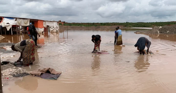 The Battery Belt on Women’s Bodies: Looking into the Gendered Impacts of Cobalt Mining in Congo
  Supporting Gig Workers in a Staggering Job Landscape
  The Tobacco Paradox: Why the Deadliest Industry Can Still Be the Most Profitable
  Addressing Asia’s E-Waste Management Gaps